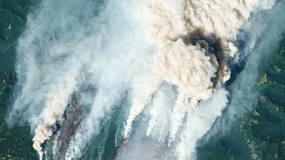
A satellite of U.S. Earth-observation company Planet shows the Cedar Creek Fire in Oregon (Image credit: Planet)
The Oregon wildfires have now made national news as the Cedar Creek Fire, which has quadrupled in size, is one of 21 fires currently burning in Oregon. According to NPR, the Cedar ACreek Wildfire is said to be the largest currently ablaze.
Space.com recently posted satellite views that capture massive clouds of wildfire smoke shrouding vast areas of the Oregon and Washington states as vicious blazes destroy hundreds of square miles of forest.
As fires grew over the past weekend, swelling to over 135 square miles (that’s 90 square kilometers), satellites captured
→ Continue reading at That Oregon Life